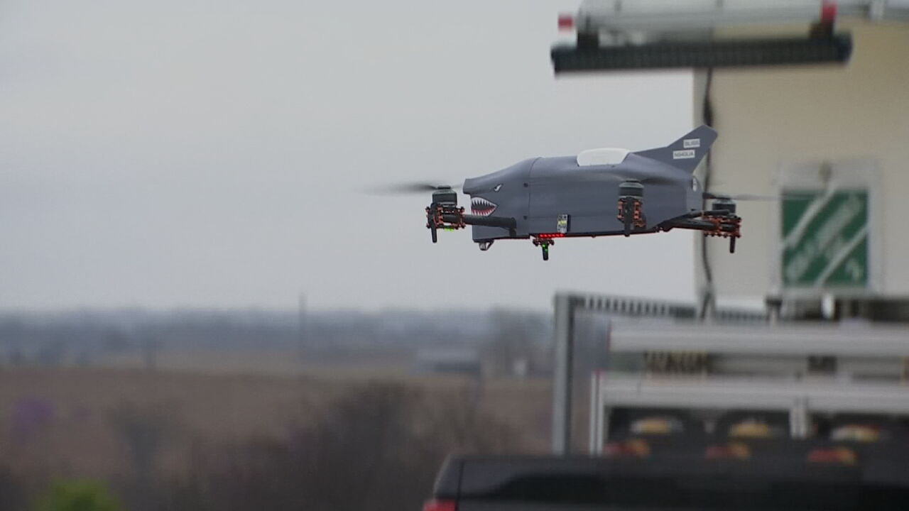
Researchers are utilizing severe weather season to study the skies. Scientists from NOAA and the University of Oklahoma are employing drones to gain a better understanding of how severe weather forms. A large field in Purcell is regularly used as a launching site for a 3D-printed drone known as “the shark.”
Equipped with sensors also found in weather balloons, the drones offer more precision in data collection. Unlike balloons that drift with the wind and are often lost upon launch, drones are able to combat the wind and navigate through the sky during severe weather events. Research engineer Dr. Tony Segales highlighted the advantages of using drones, emphasizing the ability to obtain a more accurate column of air data.
The research team, who were present during the deadly Rolling Fork tornado outbreak in Mississippi last year, experienced success in improving forecast accuracy through data collection. On quieter days, the team ventures out to gather data on various atmospheric conditions such as temperature, humidity, wind speed, wind direction, and pressure.
Research Scientist Dr. Tyler Bell expressed optimism in the potential of the drone technology to enhance weather forecasting capabilities. By collecting high-resolution data and increasing the volume of measurements, the researchers believe they can produce more accurate forecasts. This innovative approach leverages the power of flight to deepen our understanding of the sky’s dynamics.